
At the north end of Oliver Hill Way, one option is to turn left on Hospital Street and go up the hill to Gilpin and Barton Heights. If you take the right, Bowling Green Road climbs the hill and disappears into the street grid of the plateau on the way to Eastview and Whitcomb.
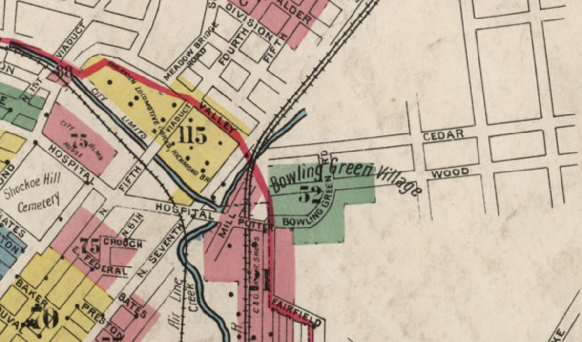
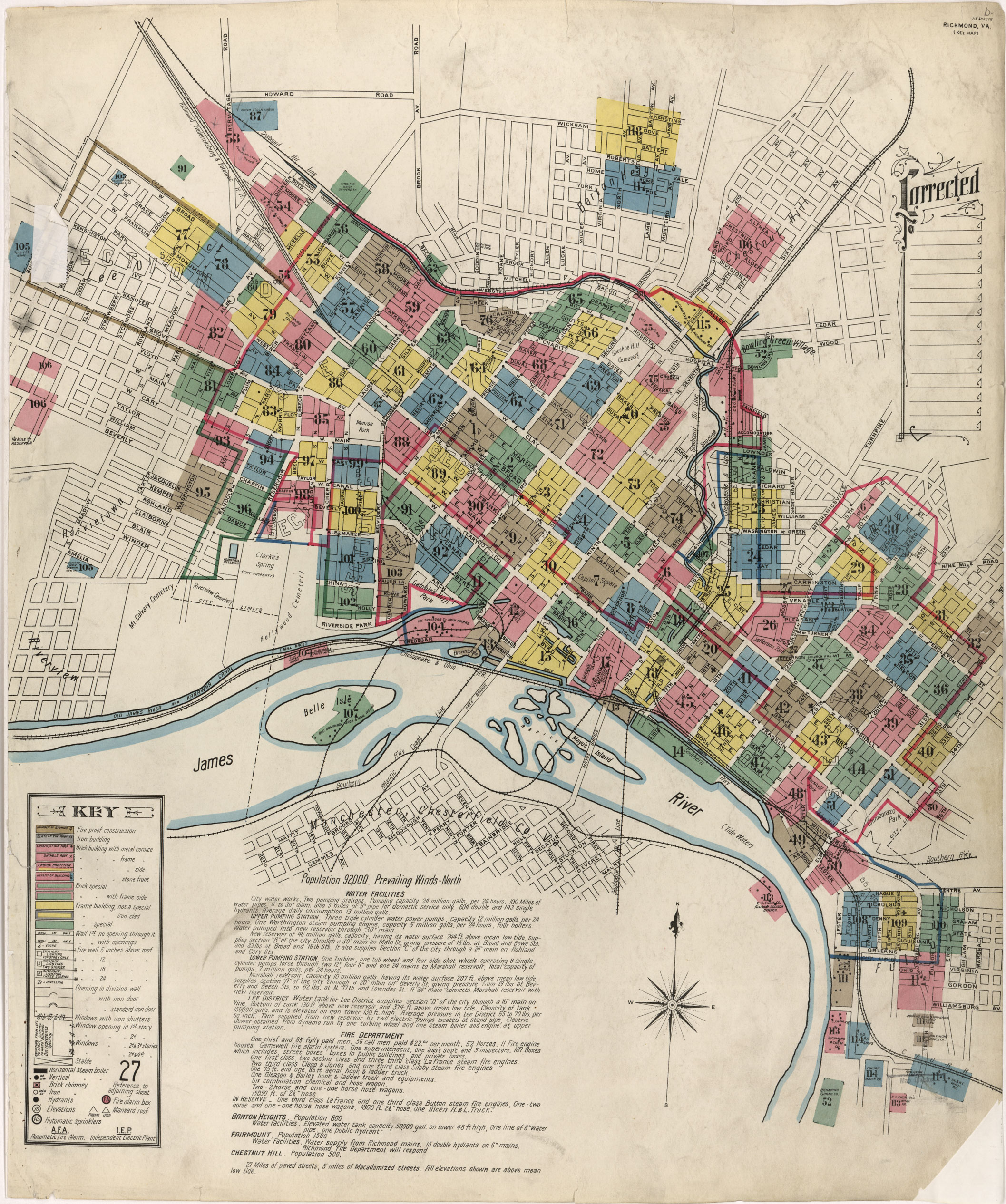
The 1905 Sanborn Insurance Map shows every building in Richmond, as well as the Henrico towns of Fairmount (annexed in 1906), Chestnut Hill, and Barton Heights (both annexed in 1914). The map also includes “Bowling Green Village” towards the top right, showing 60 or so structures along Bowling Green Road and Wood Street.
[sep]

[sep]
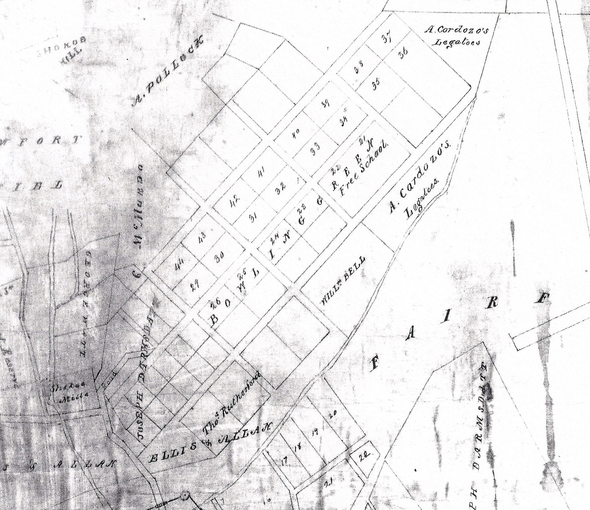
An 1831 map of the Fairfield tract includes a plat of Bowlingreen Village (BELOW), then a a community 5 blocks by 3 blocks, spreading east and north from the road up from the valley towards Mechanicsville Turnpike. That plat encompasses what is now about half of Whitcomb Court, and good part of Eastview.
The even earlier 1817 Richard Young map also shows a “Free School” a few blocks about where Chelsea Park is located.
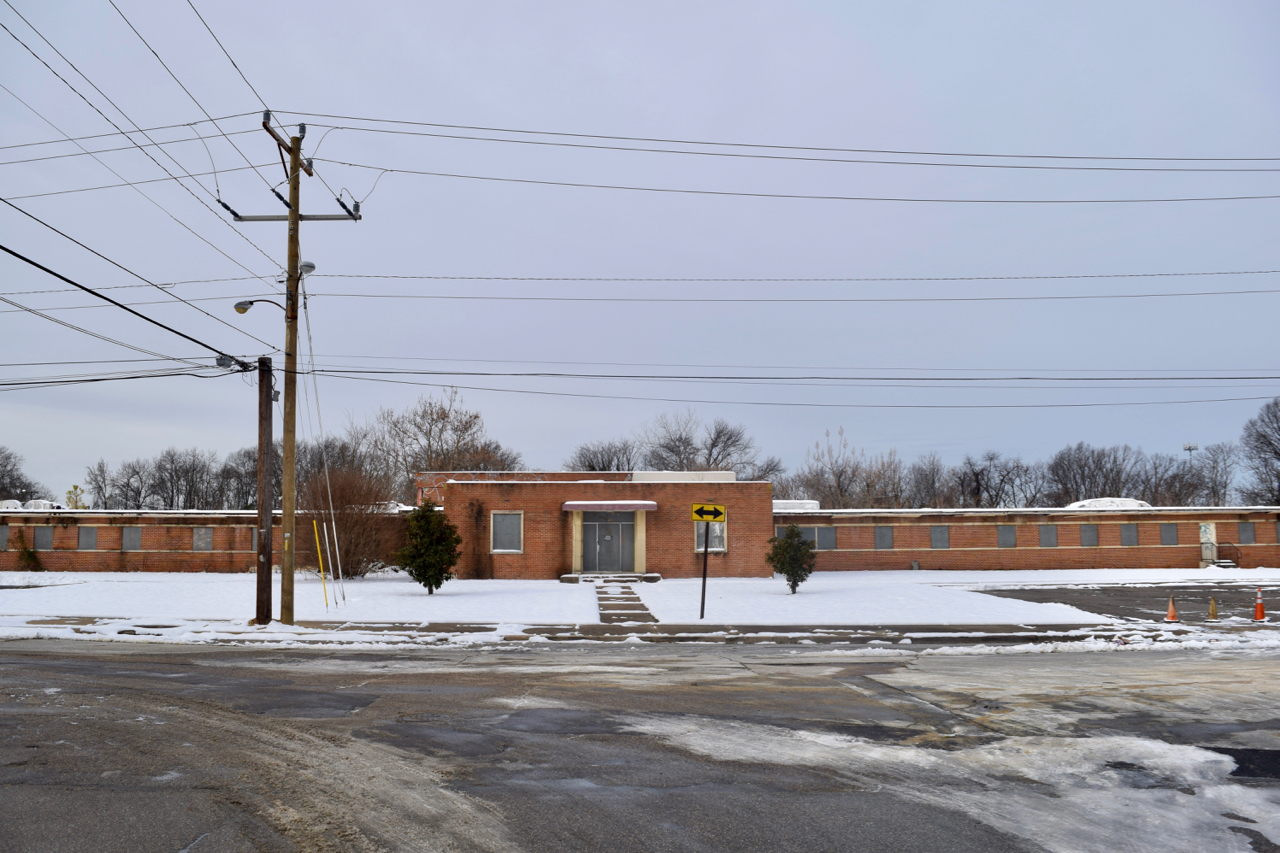
The housing stock in the immediate area now consists of blocks of modest houses built in the 1940s-1960s, adjacent to eight large apartment units and a pair of institutional buildings.
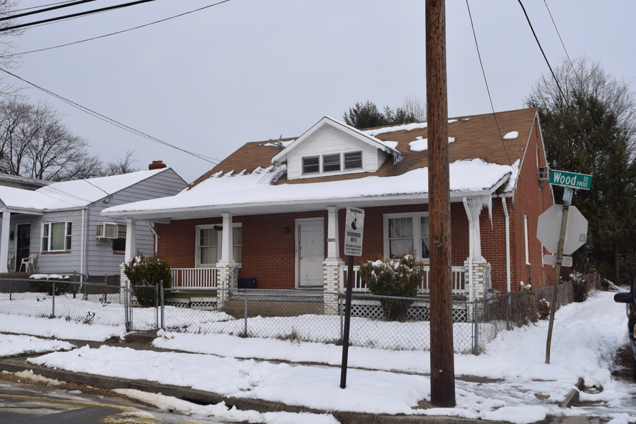
Two remaining homes at the southern end of the area predate the rest: 1934 Wood Street was built in 1926, while 1924 Wood Street shows a date of 1900 – indicating that it is likely older. There are also a handful of older homes along Whitcomb Street from the late 18th/early 19th centuries.
Immediately to the east is a large undeveloped area, labeled as Chelsea Village Park on the map. A good portion of the “park” are plotted lots along the 1900 block of Lebanon Street owned by City Of Richmond Recreation & Parks.
A 1931 map of density in Richmond (BELOW) shows about 400 people living in the immediate area of Bowling Green Village, as well as well as two streets down to the valley that no longer exist except on paper.
The city refers to the entire area as “Whitcomb”, though the entirety of the area that is not Whitcomb Court or Mosby Court is represented by the Eastview Civic League.
[sep]


[sep]

[sep]

[sep]
[sep]

[sep]

[sep]

[sep]

[sep]
[sep]
[sep]

[sep]

[sep]

[sep]

5 comments
FB_10208164217845633
FB_10153804522090834
FB_10202520247683271
FB_10210248236176147
Wow this is a great article. Alot of these pictures I’m familiar with and I see alot of these houses everyday. I’ve been living in this area for 6 years, and that house on 2405 Whitcomb street has been vacant since I’ve been living here. You can actually see my house in the background on that picture, if you look to the right of the vacant house, you can see some brown, brick houses behind the trees in the background (Conrad Street).Great article, and I’m glad to see this part of Churchill featured on this site