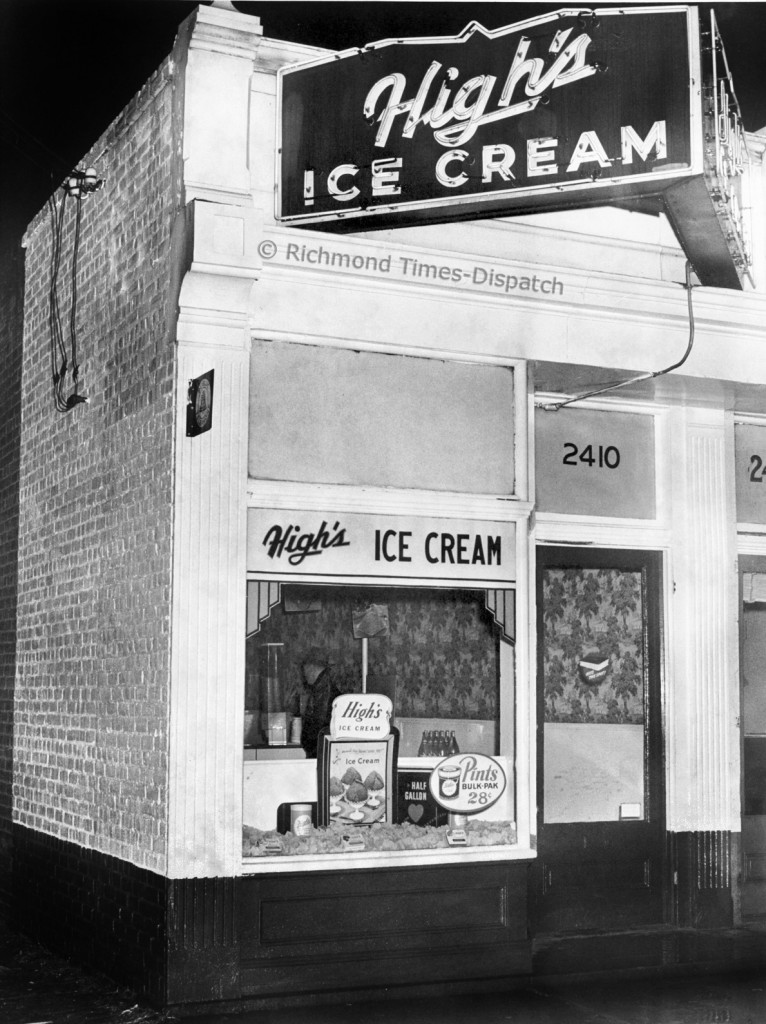
A neat photo from the RTD archives of the High’s Ice Cream store at 2410 East Broad Street.
This is the first photo that I’ve ever seen of any of the storefronts that used to be across from St.John’s. Anybody else have more?

A neat photo from the RTD archives of the High’s Ice Cream store at 2410 East Broad Street.
This is the first photo that I’ve ever seen of any of the storefronts that used to be across from St.John’s. Anybody else have more?
22 comments
Emily Nelson liked this on Facebook.
So this High’s once stood on what is now Patrick Henry Park?
Nichole Hornsby liked this on Facebook.
Brandi Watkins liked this on Facebook.
Yup!
You can see the stores in this aerial photo here, and here is a look at the corner from in front of the Church Hill bank
Gillian Field Cochran liked this on Facebook.
It’s kind of a shame these buildings were lost for a rarely used park. It would be nice to have a few more retail storefronts left in the neighborhood.
Weren’t they lost due to structural instability caused by the train tunnel and its occasional collapses?
This map does show that the tunnel runs right through there http://www.flickr.com/photos/murden/4337701820/sizes/o/
I always heard that those buildings were torn down due to a deteriorated portion of the church hill train tunnel below. The park was established to at least provide some use for the land but it was deemed unsafe for any other use.
Not sure if any of this is true…just recounting a story I’ve heard a few times about that space.
john_m, from what year is that map?
Do you know if there are any remnants of the central lunatic asylum still extant?
That map is from 1883.
None of the asylum is left. Here is a short history if you’re interested:
https://chpn.net/news/2008/07/09/a-short-history-of-the-central-lunatic-asylum_1773/
thanks. google maps cleared it up. looks like it used to be around N20th and T st, which is all residential now.
Highs Icecream storm was located at 25th and Q Street. Richmond, VA
Perhaps someday Patrick Henry Park will be eliminated. I think this might be a good direction for the neighborhood if something useful of high architectural quality was built there
The last remembrance of Highs Ice Cream Store was 12/27/68, at which time it was being robbed and at that time
I wanted some real sherbert ICE CREAM
This block is the subject of my upcoming April CHA Newsletter article. If anyone have leads to other shots of the block prior to it being demolished in 1961 please let me know.
Gillian Field Cochran liked this on Facebook.
Brandi Watkins liked this on Facebook.
Nichole Hornsby liked this on Facebook.
I grew up on Churchill between 26th and 25th of “Q” street and was lovely nieborhood with soulfull people.
I’m trying to find a picture of High’s that was located at the corner of Hanes Ave and Brookland Park Blvd in Richmond Va. If anyone has one please share. Thank you in advance.